Ha Giang Loop Map Guide: How to Plan the Route Without Rushing
If you are searching for a Ha Giang Loop map, you probably do not just want a pretty route graphic. You want to know where the loop starts, which towns to sleep in, how many days you need, which stops are worth adding, and whether the route is too much for your riding level.
The short answer: the classic Ha Giang Loop starts and ends in Ha Giang City. It usually follows this route:
Ha Giang City → Quan Ba → Yen Minh → Dong Van → Ma Pi Leng Pass → Meo Vac → Du Gia → Ha Giang City
Most travelers complete it in 3 or 4 days. Three days works if you are short on time. Four days is better if you want fewer long riding days, more photo stops, and less pressure on mountain roads.
Ha Giang Loop Map: The Classic Route
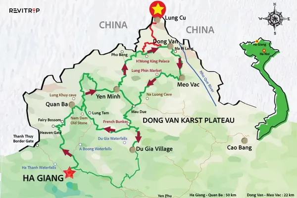
Think of the Ha Giang Loop map as a mountain circuit through the far north of Vietnam. The route connects small towns, limestone passes, ethnic minority villages, rivers, canyons, and highland markets.
The most common loop is about 320–350 km, depending on detours and where you sleep. Many travelers ride by motorbike, while others book an easy rider, private car, or small-group tour.
Here is the route in simple form:
| Day | Route | Best Overnight Stop |
|---|---|---|
| Day 1 | Ha Giang City → Quan Ba → Yen Minh | Yen Minh |
| Day 2 | Yen Minh → Dong Van → Lung Cu optional | Dong Van |
| Day 3 | Dong Van → Ma Pi Leng Pass → Meo Vac → Du Gia | Du Gia or return to Ha Giang |
| Day 4 | Du Gia → Ha Giang City | Finish in Ha Giang City |
The landscape around Dong Van and Meo Vac is part of the Dong Van Karst Plateau UNESCO Global Geopark, a northern Ha Giang region known for limestone formations, deep canyons, mountain passes, and the Nho Que River.
How Many Days Do You Need for the Ha Giang Loop?
3 Days: Best for Travelers Short on Time
A 3-day Ha Giang Loop is possible, and many tours sell it this way. The trade-off is that your riding days will feel packed.
A typical 3-day route looks like this:
Day 1: Ha Giang City → Quan Ba Heaven Gate → Yen Minh → Dong Van
Day 2: Dong Van → Ma Pi Leng Pass → Nho Que River → Meo Vac
Day 3: Meo Vac → Du Gia or Mau Due route → Ha Giang City
Choose this if you are comfortable with long road days, early starts, and fewer slow stops. If you are a beginner, a 3-day route can feel rushed.
4 Days: Best Overall Choice
For most first-time travelers, 4 days is the better plan. You still cover the key highlights, yet the route gives you more breathing room.
A practical 4-day route looks like this:
Day 1: Ha Giang City → Quan Ba → Yen Minh
Day 2: Yen Minh → Dong Van → Lung Cu Flag Tower optional
Day 3: Dong Van → Ma Pi Leng Pass → Nho Que River → Meo Vac → Du Gia
Day 4: Du Gia → Ha Giang City
This is the version I would recommend to most travelers using a Ha Giang Loop map for the first time. It gives you the big views without forcing you to ride tired in the dark.
Main Stops on the Ha Giang Loop
Ha Giang City
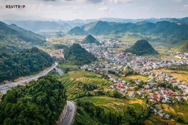
Ha Giang City is the starting point, not the scenic highlight. Most travelers arrive by sleeper bus from Hanoi, pick up a motorbike or meet their easy rider, and spend one night here before starting the loop.
Do not skip the briefing if you rent a bike. Ask about brakes, lights, helmet quality, insurance, route conditions, and what to do if the bike breaks down.
Quan Ba Heaven Gate
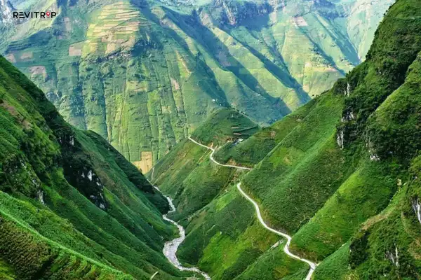
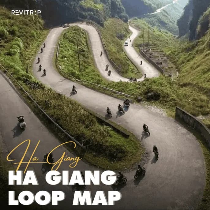
Quan Ba is usually the first dramatic mountain section after leaving Ha Giang City. This is where the road starts to feel like the loop people talk about.
The famous viewpoint looks across layered green valleys and the Twin Mountains. It is a good early stop, especially if you need a break after the first climb.
Yen Minh
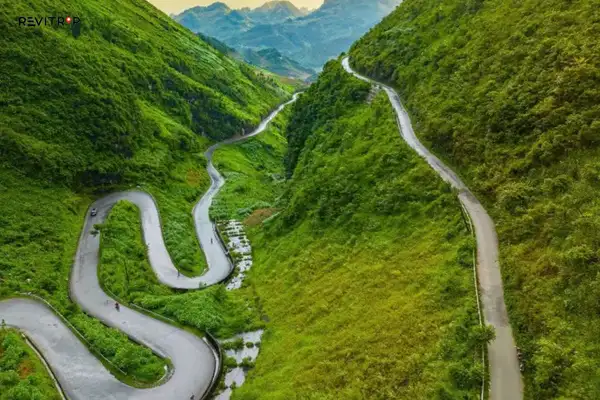
Yen Minh is a practical overnight stop, especially on a 4-day itinerary. It is quieter than Dong Van and has enough homestays and simple restaurants for one night.
The mistake many travelers make is treating Yen Minh as just a place to sleep. The road before and after town is part of the experience, with pine forests, sharp bends, and cooler mountain air.
Dong Van
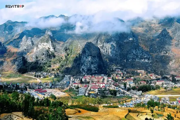
Dong Van is one of the best bases on the loop. It has more guesthouses, cafés, restaurants, and traveler services than most towns on the route.
If you are interested in local markets, try to time your stay for Sunday morning. Dong Van Market is busy, colorful, and far more interesting if you go early before tour groups fully arrive.
If Dong Van is one of your main stops, this detailed guide to planning your trip to Dong Van, Ha Giang can help you decide what to do around town.
Lung Cu Flag Tower

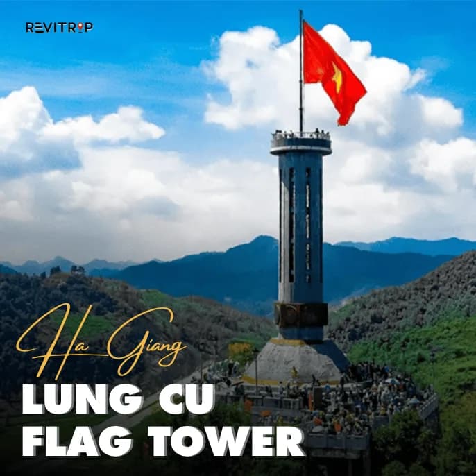
Lung Cu is a popular side trip from Dong Van. It is often described as Vietnam’s northernmost landmark, though the exact border geography is more complicated.
Go if you have enough time and energy. Skip it if the weather is foggy or you are already tired. The detour adds distance, and the views are less rewarding if visibility is poor.
Ma Pi Leng Pass
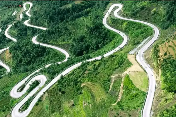
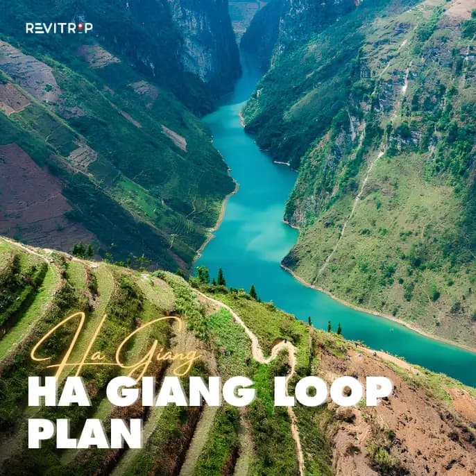
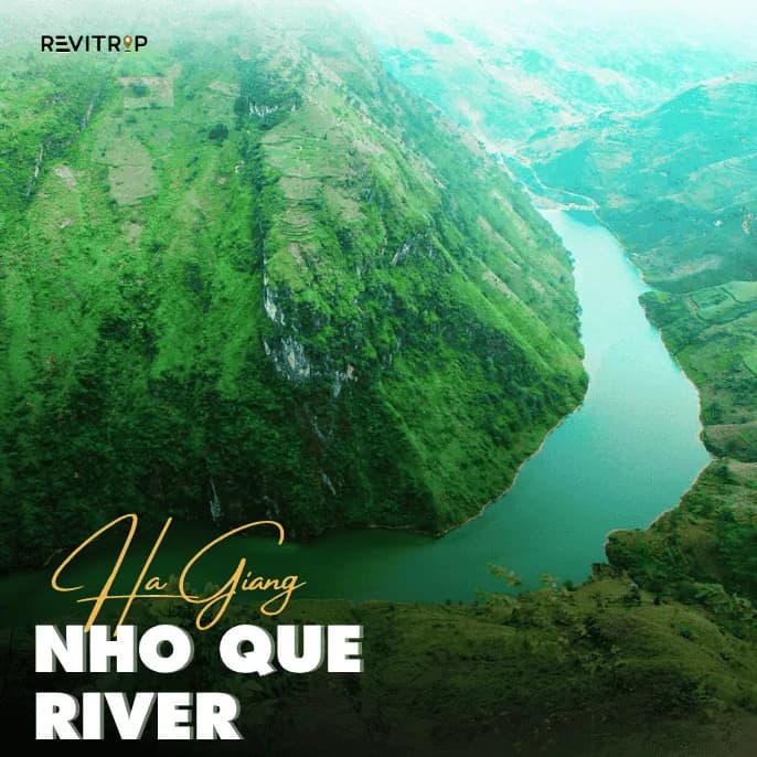
Ma Pi Leng is the section most travelers remember. The road cuts along steep cliffs above the Nho Que River, with limestone peaks rising on both sides.
This is also where you need to slow down. The views are huge, the corners are sharp, and people often stop suddenly for photos. Ride defensively and never park in the middle of a curve.
UNESCO highlights Ma Pi Leng Pass and the Nho Que River as key landscapes of the Dong Van Karst Plateau area.
Nho Que River

The Nho Que River boat ride is one of the most popular add-ons near Ma Pi Leng. It gives you a different view of Tu San Canyon, with cliffs rising above the water.
The main thing to know is that the boat ride takes time. You need to ride down, park, buy a ticket, wait if it is busy, then return to the main route. Add it only if your day is not already overloaded.
Meo Vac
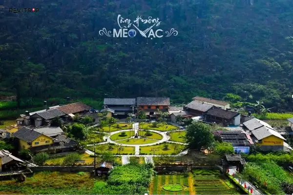
Meo Vac is less polished than Dong Van, which is part of its appeal. It works well as a lunch stop or overnight stop, depending on your route.
If you like food and local markets, Ha Giang is also known for highland dishes such as thắng cố. You can learn more about this local specialty in Revitrip’s guide to thang co in Ha Giang.
Du Gia
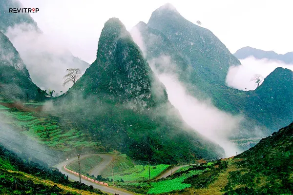
Du Gia is the slower, softer ending to the loop. Expect rice fields, village roads, homestays, and a more relaxed atmosphere.
If you only have 3 days, Du Gia can make the final day long. If you have 4 days, it is one of the best places to add.
Should You Ride Yourself or Book an Easy Rider?
This is the most important decision after choosing your route.
Riding yourself gives you freedom, but Ha Giang is not a beginner-friendly place to learn motorbiking. The route includes steep drops, blind turns, trucks, rain, fog, loose gravel, and animals on the road. Recent reporting has also raised concerns about accidents, road hazards, and inconsistent safety standards on the Ha Giang Loop.
For US travelers, there is another issue: licensing. The U.S. Embassy in Vietnam warns that foreign driver licenses are not valid in Vietnam, even when accompanied by an international driving permit.
If you are not fully confident, book an easy rider. You still get the open-air motorbike experience, but a local driver handles the road.
Choose self-riding only if you have real motorbike experience, proper travel insurance, and a clear understanding of the legal and safety risks.
Best Ha Giang Loop Map Route by Travel Style
Best Route for First-Timers
Choose the 4-day route:
Ha Giang → Yen Minh → Dong Van → Meo Vac → Du Gia → Ha Giang
This gives you the classic highlights without rushing every stop.
Best Route for Photographers
Spend more time around Dong Van, Ma Pi Leng, and Du Gia. Start early each day because the best light often comes before the roads get busy.
Best Route for Culture and Markets
Plan around weekend markets in Dong Van or Meo Vac. If your trip overlaps with seasonal events, this guide to the top festivals in Ha Giang can help you choose better travel dates.
Best Route for Nervous Riders
Do not self-ride. Book an easy rider or car tour. You can still enjoy the same map route with far less stress.
Common Ha Giang Loop Map Mistakes
The first mistake is trusting distance too much. A 90 km day in Ha Giang can feel longer than 160 km elsewhere because of curves, stops, climbs, fog, and rough patches.
The second mistake is starting late. Try to leave by 8:00 AM. Arriving before dark is one of the easiest ways to reduce risk.
The third mistake is adding every viewpoint. The map may show several famous stops close together, yet each one takes time. Choose fewer stops and enjoy them properly.
The fourth mistake is booking only by price. Cheap tours can mean large groups, weak helmets, tired drivers, or rushed schedules. Ask about group size, bike condition, rain gear, insurance, and overnight stops before paying.
When Is the Best Time to Ride the Ha Giang Loop?
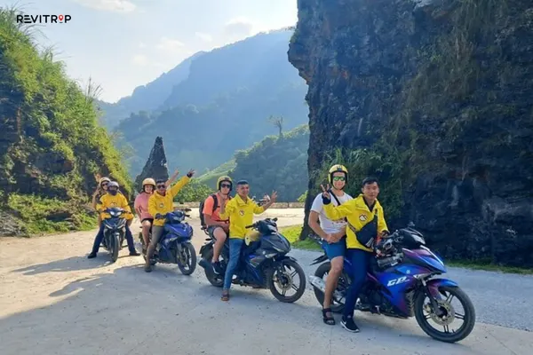
The most comfortable months are usually March to May and September to November. These periods often bring clearer views, less extreme cold, and better riding conditions.
October and November are popular for buckwheat flowers in the Dong Van area, while January and February can bring peach and plum blossoms. UNESCO also notes these seasonal blooms as highlights of the geopark region.
Summer can be green and dramatic, but rain can make roads slippery. Winter can be beautiful, yet fog and cold weather can reduce visibility on high passes.
Budget Notes for the Ha Giang Loop
Your budget depends heavily on whether you self-ride, book an easy rider, or join a tour.
A simple self-ride trip usually includes:
- Motorbike rental
- Fuel
- Homestays or guesthouses
- Food and drinks
- Entrance fees or boat rides
- Rain gear or protective gear if not included
An easy rider costs more, but it can be a better value if you care about safety, local knowledge, and less planning stress.
Do not choose the cheapest option if the operator seems careless. On this route, safety is part of the product.
Final Advice: How to Use a Ha Giang Loop Map Well
A good Ha Giang Loop map helps you understand the shape of the journey, but it should not control every hour of your trip.
Use the map to choose your overnight towns first. Then add viewpoints, markets, and side trips only if they fit your riding time and weather.
For most first-time travelers, the best plan is simple: take 4 days, sleep in Yen Minh, Dong Van, and Du Gia, leave early each morning, and do not ride after dark.
Ha Giang is one of Vietnam’s most powerful road trips. Treat the route with respect, choose the right pace, and the map becomes much more than a line through the mountains.
FAQ
Yes, many travelers use a Ha Giang Loop map PDF before starting the trip, but you should not rely on a PDF alone. Road conditions, detours, weather, and overnight stops can change. Use the PDF for planning, then check Google Maps, your homestay, or your tour operator before riding each day.
For most first-time travelers, 4 days is the best choice. A 3-day Ha Giang Loop is possible, but it feels rushed and leaves less time for photo stops, markets, and bad weather. A 5-day route is better if you want a slower pace, extra village stops, or more time around Dong Van, Ma Pi Leng Pass, and Du Gia.
Yes, Google Maps is useful for following the main Ha Giang Loop route, checking distances, and finding towns like Yen Minh, Dong Van, Meo Vac, and Du Gia. Still, do not follow it blindly. Some suggested shortcuts may be rough, steep, or unsuitable after rain, so it is best to confirm the route locally before leaving each morning.